
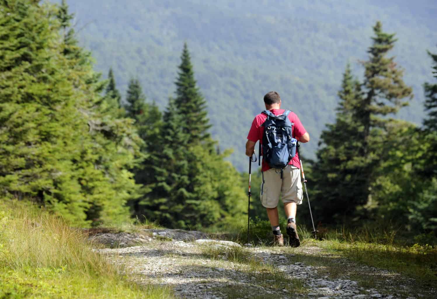
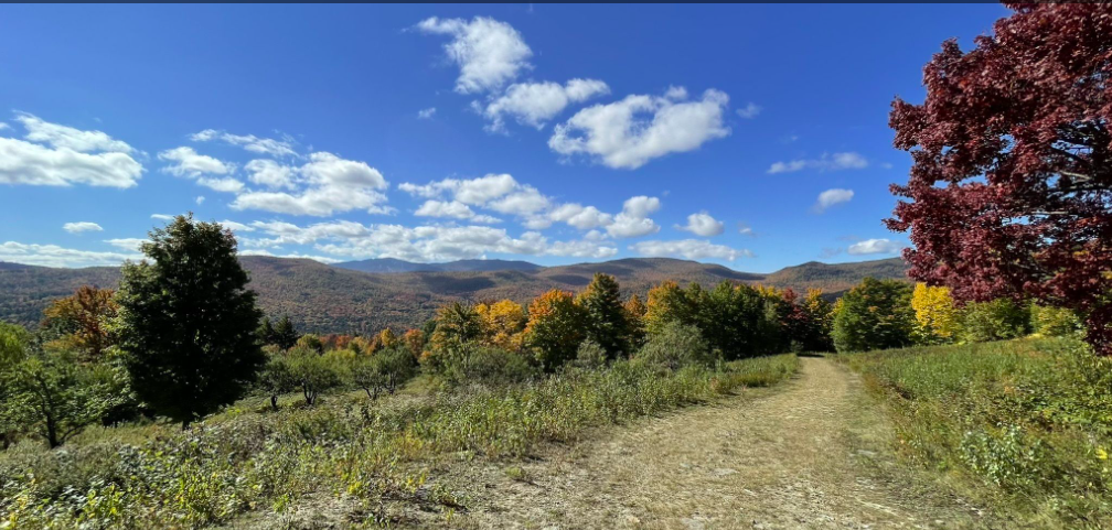
Howe Block – Camel’s Hump State Forest

An array of trails that emanate efrom the top of Tucker Hill Road leading to the Mad River Valley Recreation Hub, downtown Waitsfield and Lareau Farm.
Read MoreWarren Covered Bridge

In the town of Warren there is a covered bridge over the Mad River. There is a very small swimming area under this bridge. Follow Main street in either direction…
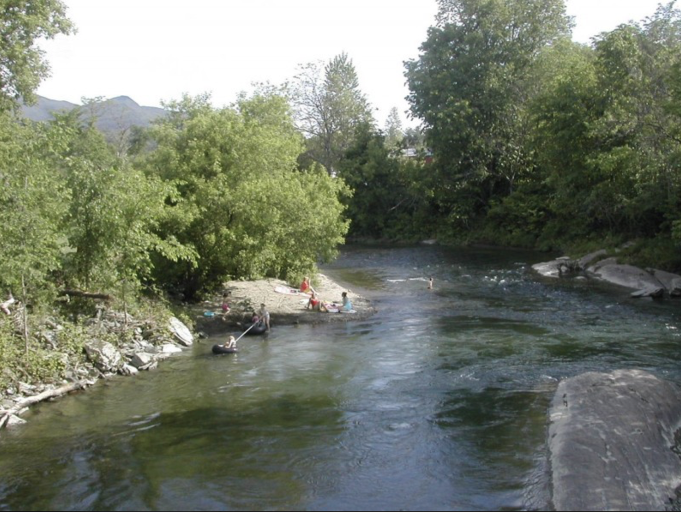
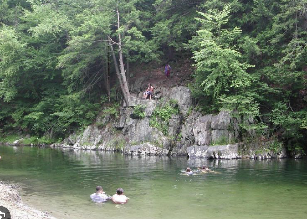
Read MoreWarren Falls
Warren Falls is located in Warren, Vermont, and is a favorite local swimming hole on the Mad River. There are several cliff jumping locations with varying heights. The 10-foot, 15-foot,…
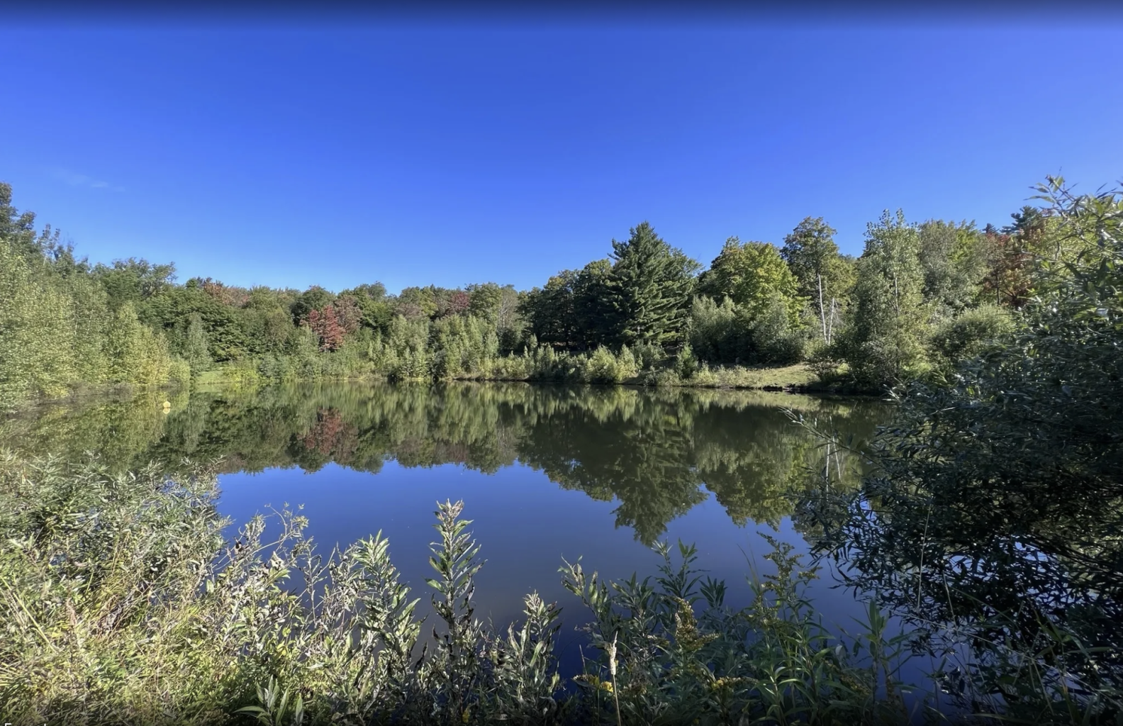
Read MoreBlueberry Lake

A beautiful small lake part of the Green Mountain National Forest. A pleasant beach with hiking/biking trails and awesome views.
Read MoreMoretown Gorge

Located in the village of Moretown, this swim hole offers a rocky beach, a large swim hole and rocks to jump off of. Get a creemee over at the Moretown…
Read MoreBridges Resort Pool

Indoor and outdoor pools along with a health club and tennis
Read MoreSugarbush Health & Raquet Club Pool
The Sugarbush Health and Raquet Club has both an indoor and outdoor pool as well as an array of other amenities.
Read MoreBoyce Hill Town Forest Pond
Historically, previous landowners have turned a blind eye to members of the public swimming in the pond during the summer and skating on the ice in the winter. The Town…
Read MoreWest Greenway Swim Hole
Good for the whole family, go down the bank to the pebbly beach and wade into the cool, flowing Mad River. There are rocks that form a gentle “rapid” to…
Read MoreWard’s Swim Hole

Just north on Rt. 100B in Moretown is a gem of a swimming hole and small park. There are rocks to climb, boulders to hop, and a large grassy area…
Read MoreRiverside Park
Classic Mad River swim hole in Warren. Access to a s section of the Mad River Path and a beautiful lawn to picnic and recreate. This quiet Mad River swimming…
Read MoreGreat Eddy Swim Hole
The MRV’s most popular swim hole located right next to Waitsfield’s famous Great Eddy Covered Bridge.
Read MoreBolton Backcountry
The Bolton Backcountry is not a CTA/Chapter managed area. It is an independent area managed and maintained by the Friends Of Bolton Valley Nordic & Backcountry, and Bolton Valley Resort.…
Read MoreBraintree Mountain Backcountry Ski Zone

In 2013 Paul Kendall and his wife Sharon Rives, donated 1,547-acres to the New England Forestry Foundation (NEFF). The parcel is known today as the Braintree Mountain Forest. Located off…
Read MoreBrandon Gap Backcountry Ski Zone
The Brandon Gap Backcountry Recreation Area is a Ridgeline Outdoor Collective lead project in partnership with the United States Forest Service (USFS). The Brandon Gap Backcountry Recreation Area is located…
Read MoreCatamount Trail
The Catamount Trail is Vermont’s long distance ski trail that runs from the Massachusetts border to the Canadian frontier. It was created by three young men looking for their next…
Read MoreHistory Tour of South-Central Vermont
This tour heads south from the MRV down iconic VT Route 100 towards the Calvin Coolidge Homestead, the birthplace and historic site of Vermont’s only Presidential before heading east and…
Read MoreChamplain Valley Tour
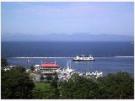
Head west over the Appalachian Gap and descend into the picturesque Champlain Valley. Along the 100 plus mile 2.5 hour loop there are lots of places to stop and check…
Read MoreThe Northern Loop
This 76 mile tour takes you north to Waterbury, Stowe, and up through Morrisville. Then it wraps around the Worcester Mountains through Scenic Elmore and Worcester along scenic Route 12.…
Read MoreCapital District Excursion

Along this 55 mile loop you’ll visit Vermont’s twin cities of Montpeleir and Barre. Montpelier is Americas smallest state capital while it’s neighbor, Barre is the granite capital of the…
Read MoreDouble Gap Mountain Trek

This drive features spectacular mountain views, thrilling ups and downs, and the very best foliage that Vermont has to offer. You travel over the Lincoln Gap (CLOSED IN WINTER)which, at…
Read MoreMad River Scenic Byway

The Mad River Byway is a 35 mile foray through the heart of Vermont, passing around or through lovely and lively downtowns, farms, famous ski areas (Sugarbush and Mad River…
Read MoreThe Full Monty Covered Bridge Tour

This ever-popular driving tour delivers 7 Bridges in just under 40 miles with spectacular scenery along the way. This tour will take you “off-the-beaten-path” to discover some places, experiences and…
Read MoreNorthfield – Roxbury Route 12 Loop

The Northfield Mountains create the eastern edge of the Mad River Valley. This 37 mile loop goes over two of the gaps that criss-cross the range. It features stretches of…
Read MoreEast Warren Loop
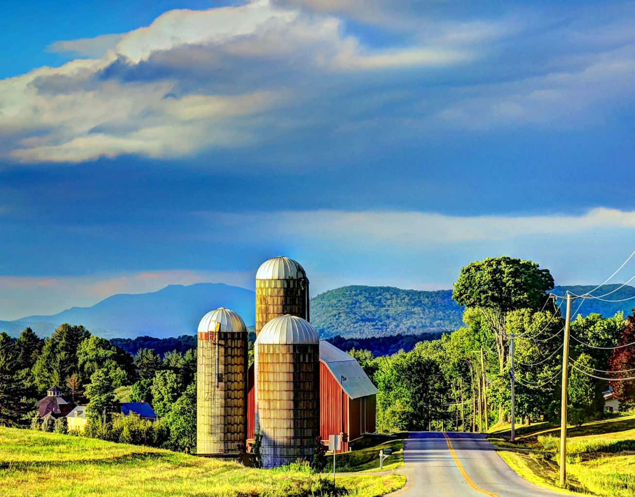
This 10 mile loop delivers long vistas and bucolic agricultural landscapes. If you can stop, park and stretch out those legs, this adventure has lots of places to enjoy a…
Read MoreWest Hill Loop

This is a great add-on loop if you want to explore the beautiful landscape above Warren Village and back around via the Lincoln Gap Road. Consider making a side-trip “UP”…
Read MoreBragg Hill Loop

This relatively short loop delivers some of the MRV’s most spectacular views year-round. Hard up against the intersection of Route 100 & Route 17 turn up Bragg Hill Road. You’ll…
Read MoreClassic MRV Driving Tour
If you’re pressed for time and you can do just one jaunt around the MRV on your visit, this is the one! It’s also a great way to get the…
Read MoreMiddlesex Town Forest
The Middlesex Town Forest has a small network of trails. You can hike up the Notch Road, a class 4 dirt track that runs for 0.7 miles one-way. For a…
Read MoreMoretown Town Forest

This relatively small 2.5 mile multi-use trail system is popular among hikers and mountain bikers. The network can be accessed from either the Moretown Elementary School parking lot or from…
Read MoreLittle River State Park and Cotton Brook Trails

Suggested Trails in the Little River State Park Network Dalley Loop Trail The trail follows an old logging road through the forest, over small brooks, and past the remains of…
Read MoreSpruce Mountain
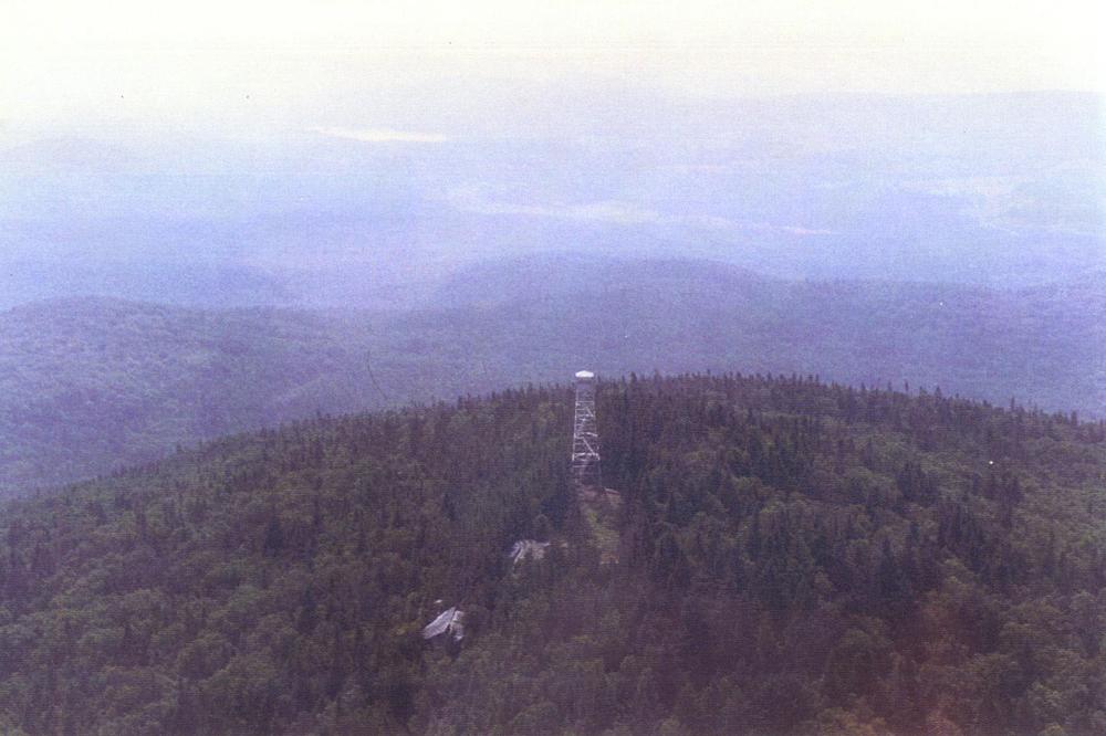
Spruce Mountain is located in LR Jones State Forest, the oldest State Forest in Vermont. The 2.2 mile trail to the summit of Spruce Mountain, a 3,037 foot peak, climbs…
Read MoreMount Hunger via Waterbury Trail

The Waterbury Trail is a 5 mile out and back trail that takes hikers up through C.C. Putnam State Forest to the summit of Mount Hunger. The ascent is steady…
Read MoreGeneral Stark Mountain via Stark Mountain Trail
The Stark Mountain Trail is 2.5 miles to the summit or 5 miles round trip. with a 2,036’ of vertical gain. This trail follows a wide, well established, “work road” up to…
Read MoreBurnt Rock Mountain
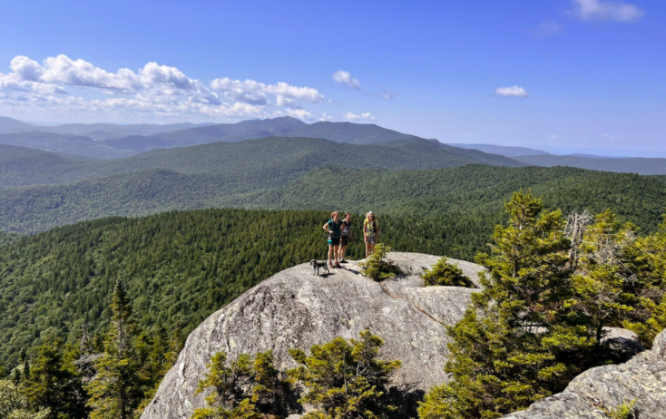
A steep, 5.2 mile round-trip that takes you up to some of the best viewing on the Long Trail. The trail begins at the parking lot at the end of…
Read MoreWu Ledges Trails
Please note that parking at the trail head is exceedingly limited (only 2 spots). Please respect the homeowners property when parking. There are three main trails at Wu Ledges. A…
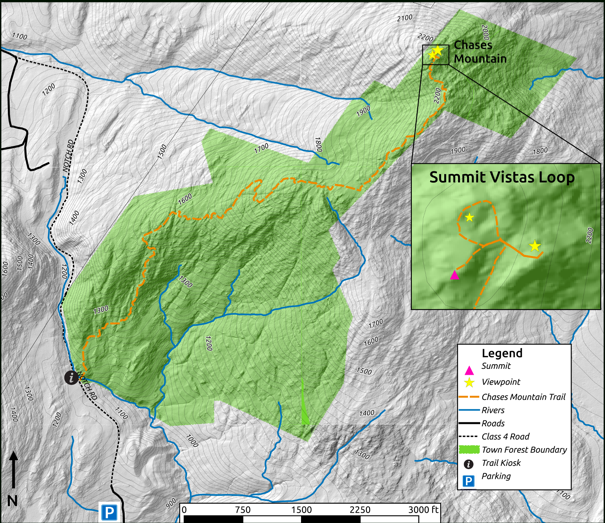
Read MoreScrag Mountain Trails

The out and back trail to the beaver pond near the summit of Scrag Mountain is 4.2 miles in length. This 750 acre forest, owned by the Town of Waitsfield,…
Read MoreBlueberry Lake Trails
The Blueberry Lake trails are multi-use trails that are most popular for hiking and mountain biking. They were designated in 2013 as an International Mountain Bike Association Model Trail-Gateway network…
Read MoreBoyce Town Forest Trail
A gentle 1.2 mile round trip hike where you will hike up an old road through alpine meadow to gentle peak with 270-degree view. Can see Mad River Glen, Mt.…
Read MoreMad River Path – Warren Path, Vista Trail and Interpretive Trail

A network of easy to advanced trails through forests studded with rock outcrops and boulders. The Warren Path & Interpretive Trail provide recreation hiking opportunities starting at Brooks Field. Warren…
Read MoreMad River Path – Yestermorrow Path
A short path that winds along the edge of a beautiful meadow and through the Yestermorrow Building and Design School campus. This 1/3 mile mostly grassed section connects the Kingsbury…
Read MoreChase Brook Town – Marble Hill Forest Trails

These moderate to expert trails include a portion of the Catamount trail and are great for mountain biking and hiking in the warmer months. Link directly to the Eurich Pond…
Read MoreMad River Path – Mill Brook Trail

A hiking trail through many types of forests with connections to other trail systems. The Mill Brook Trail is a hiking oriented section of the network with sometimes steep, rocky,…
Read MoreMad River Path – Austin Walk

A short walk in the riparian zone of the Mad River along with access to the Lareau Swimming Hole. Austin Walk starts at the north end of the parking lot and…
Read MoreMad River Path – Fiddler’s Walk
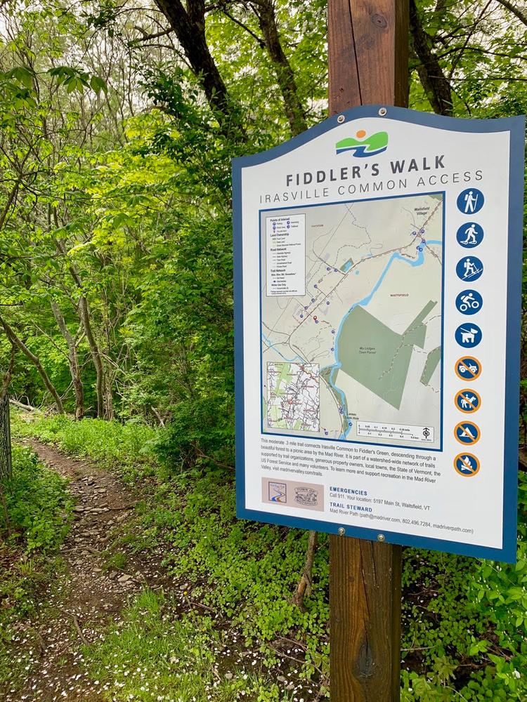
A short walk connecting Irasville Common to the banks of the Mad River. This moderate trail connects Irasville Common to Fiddler’s Green along the Mad River. It passes by the Irasvile…
Read MoreMad River Path – Hosford’s Heart of the Valley Trail

A pathway that connects the historic Waitsfield Village to the towns commercial center and provides access to the Mad River. The Hosford Heart of the Valley Trail, named after community…
Read MoreMad River Path – Wait’s Way

A flat and easy.5 mile ou and back path. Wait’s Way tucks behind the elementary school and along the river to the north of the General Wait House. It is a…
Read MoreMad River Path – Spaulding Greenway
This 1-mile section of the Mad River Path network is flat and easy and offers mountain views. The Spaulding Greenway follows the outside edge of an active farm field and along…
Read MoreMad River Path – Kingsbury Farm Path
Kingsbury Farm Path – The Kingsbury Farm Path heads north and is an easy 1 mile trail (out and back) traveling between a riparian buffer and farm fields to its terminus…
Read MoreCapital District Excursion
Along this 55 mile loop you’ll visit Vermont’s twin cities of Montpelier and Barre. Montpelier is America’s smallest state capital while its neighbor, Barre is the granite capital of the…
Read More